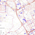
Mobility; Parking capacity; Electricity demand; GIS; Amsterdam Metropolitan Area Data article, developed with Bardia Mashhoodi for Data in Brief journal in the context of the EVA research project. Abstract: The dataset combines and aggregate five data types of the Amsterdam Metropolitan Area in a polygon GIS shapefile with 79 three-digit postcode areas, and a csv […]
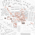
Hortaleza, a small village in the North-East of Madrid was absorbed by the expansion of the city in the 1960s. We studied the morphological changes experienced by the historic center of Hortaleza in Madrid, providing insights for local conservation policies. It was led by the urban design and planning office Paisaje Transversal and commissioned by […]
Electric Vehicle Charging Infrastructure for Amsterdam Metropolitan Region (EVA) project is a research project developed by Wageningen University & Research, commissioned by the VerDuS program Smart Urban Regions of the Future. The objective of the project is to develop approaches to determine how and where to locate electric vehicle charging infrastructure. The study is multi-scalar, […]
Research by design on alternative on-demand mobility systems. Led by 1010au and commissioned by the Province East-Flanders, Atelier OVK, Belgium. The Oost-Vlaams Kerngebied, a network of cities and municipalities around Ghent, expects a population increase by 15 to 25 percent by 2050. This research by design is part of the Atelier Oos-Vlaams Kerngebied (OVK) effort […]
The project REsource Management in Peri-urban Areas: Going Beyond Urban Metabolism was funded by the EU under a H2020 scheme. Its main objective was to provide local and regional authorities with an innovative transdisciplinary and open-source geodesign decision support environment (GDSE) developed and implemented in living labs in six metropolitan areas. The GDSE allows creating […]


